|
Aerial photo of the city of Caldas da Rainha 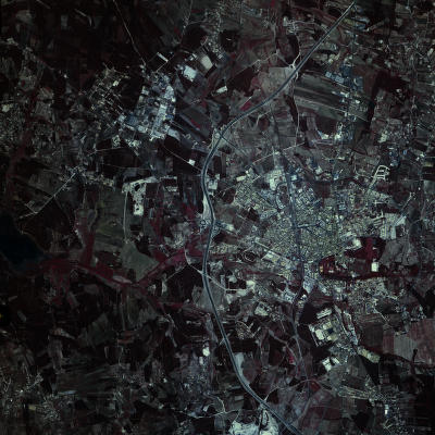
Aerial photo of the Lagoa de Óbidos connecting to the Ocean 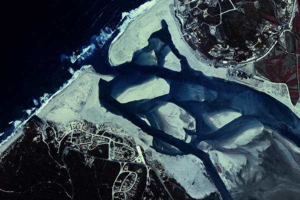
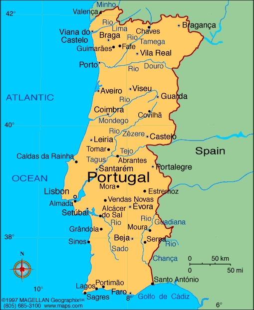
How to get to Caldas da Rainha: The city is reasonably well served by a network of roads that link it to other parts of the country.
Now the railway line is a different case... if you're a tourist, like to travel in old trains from the late 50s and 60s, have time and want to see the landscape of the region, you can use the Railway line but if you're in a bit of hurry to get there, then by car or bus it's your best alternative.
If you come from Lisbon the best alternative is Highway 8 (A8) which brings you right into the city.
If you come from the north, take A1 from Porto to Lisboa. Exit that highway in Leiria and take A8 into Caldas da Rainha or then leave in Santarem and take A15 also to Caldas da Rainha.
Some distances:
Lisboa - 82 kms
Obidos - 5 kms
Batalha - 39 kms
Foz do Arelho (beach)- 8 kms
Alcobaca - 22 kms
Leiria - 54 kms
Porto - 243 kms
Coimbra - 119 kms
Faro - 385 kms
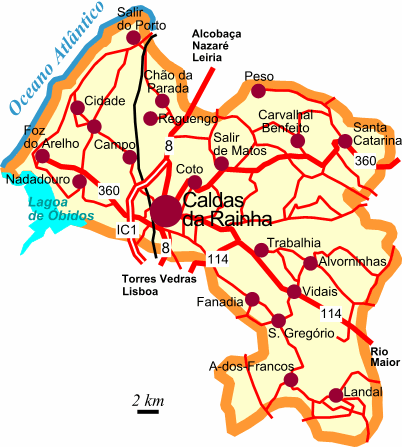
Main Roads serving the Municipality:
A8 - Comes from Lisbon (Loures) and passes by Torres Vedras, Bombarral, Obidos into Caldas, Alcobaca, Nazare, Marinha Grande and Leiria.
A15 - Links the municipality to Rio Maior and Santarem. From the one you can follow A1 and IP6 to follow to North or to the Interior of Portugal and the Border.
EN 8 - Crosses the Municipility from South to North conecting it to other municipilaties like Alcobaa and Leiria (North) or Obidos, Bombarral, Torres Vedras (South).
EN 114 - Located in the middle and SW of the municipality, links it to Rio Maior
EN 114-1 - Located it in the middle and East of the municipality. Connects itself to EN 114.
EN 115 - Starts near Caldas and has a S, SE route, following the borderline of the municipality. Connects Caldas da Rainha to the municipality of Cadaval.
EN 360 - This road begins in Foz do Arelho and has a route SW/NE linking the municipality to Benedita in the municipality of Alcobaca.
EN 361 - Located SE of the municipality links that area to the municipalities of Cadaval and Rio Maior.
|